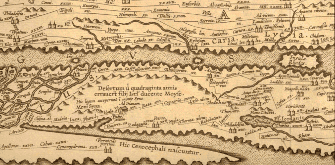
used by pilgrims like the Pilgrim from Bordeaux.
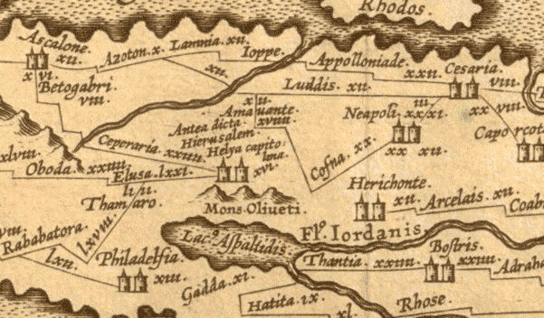
The Peutinger Map (TABULA PEUTINGERIANA) is an ITINERARIUM for the network of roads of the Roman Empire. It is a medieval copy of a 4th century revision of an original map. North is oriented to the right. Also, an enlargement of Jerusalem.
Helya Capitolina antea dicta Hierusalem:
Aelia Capitolina, formerly called Jerusalem

